I have wanted to do this canyon since early 2003. Back then it was an unknown gem in the Robbers Roost area of Utah. The canyon is located 50 miles South of Green River, Utah. It is broken into the main, east and west forks. The east and west fork join the main fork just above the “dark narrows”. In April of 2003 it became famous when
Aron Ralston got trapped and had to amputate his own arm to survive in the dark narrows. I put it on the back burner and waited till it was old news and not such a popular designation.
Finally the planning was finished, the date was picked, and the climbing party was established (Nick Carlson, Chris Lighthiser - aka CL, Jennifer and myself), we set out for the 6 hour drive to Green River.

Once there we met up with a gentleman by the name of Phil. I had found his name through a series of calls looking for a shuttle. The plan was to have Phil lead us to the Horseshoe Canyon Trailhead where we would leave our car, then shuttle the four of us to the other end of the canyon to the west fork entrance, making it a Point A to B trip instead of a loop.
Phil dropped us off in the middle of the Utah desert and was unsure this was the correct place, but the GPS told other wise and I felt comfortable enough, so we decided to go for it. At this time it was raining extremely hard, so we threw together our packs and started towards the entrance of the canyon. We got to a patch of trees and decided to camp there.
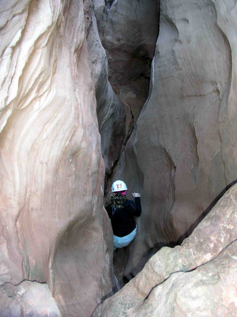
The next morning, we awoke to sunshine, so we packed camp and began down the canyon. We got to the narrow section of the canyon and began the adventure. The first ¼ mile was a chimney down (a technique where you use your feet and arms to squeeze into the canyon and ease yourself down a vertical section).
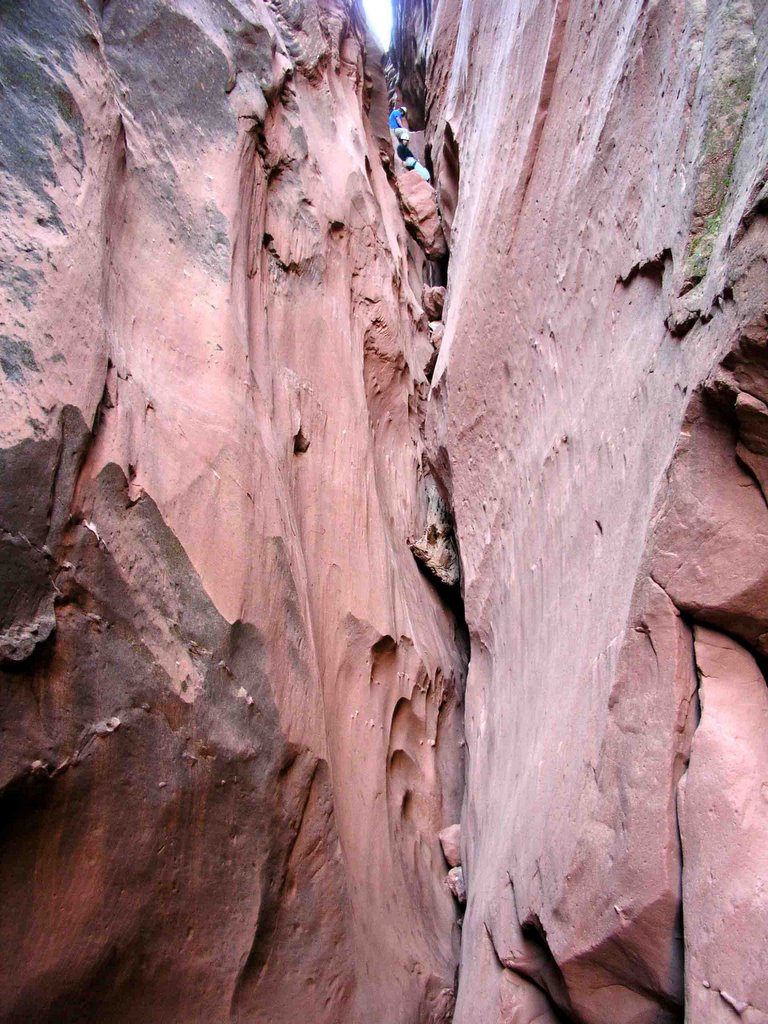
This was grueling and very tiresome but we eventually made it to the bottom of this section, packs and all, and began the hike into the narrow section of the canyon. The narrows were nice and long and we did not run into many obstacles. Once out of the narrows section, it was a good 2-3 mile exposed hike to the dark narrow section of the main fork.
Once inside the dark narrows, it became extremely tight, deep and dark. It began to squeeze down to the point where you could not have you pack on and dark enough to have to use your headlamp to see anything.
We made it to a part where Dave from the Hanns Flat ranger station had told us we could get into waist deep water. CL lowered me 10’ via belay into the water and sure enough, it was waist deep. Once to the other side we took a moment to think of a plan.
I would shuttle the packs across the water and then get under the others and help them down and limit how much they would get wet. Then CL would tie some webbing around a choke stone (a stone or rock washed down stream that gets wedge in the narrow canyon) and lower himself down into the water.
The plan worked well and everyone escaped without getting into the water.
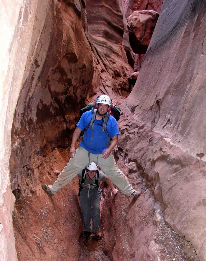
After cleaning up and getting dry, we continued down stream. I was bringing up the rear and all of a sudden heard “HOLY COW” (language cleaned up for family viewing) come from the front half of the party.
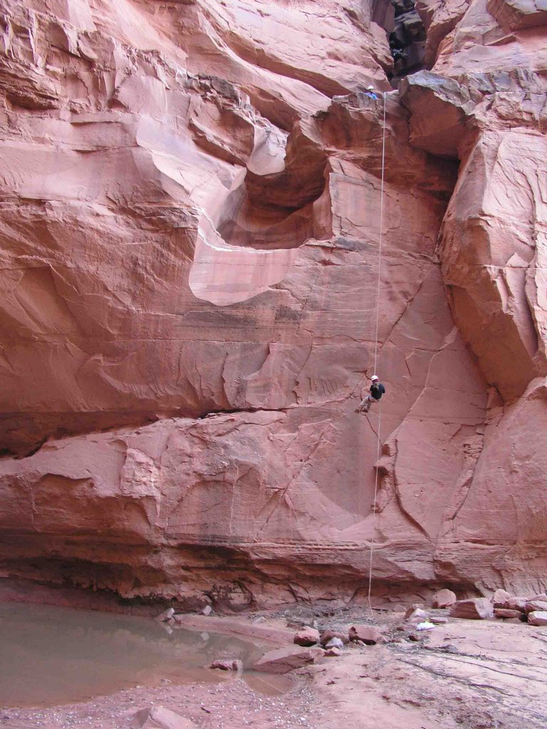
I turned a corner and saw what appeared to be longer than a 60’ drop to the canyon floor. We were prepared to repel down 60’ and were expecting it. But what we saw looked longer than that. We threw the rope over and there was less than 4 feet of rope on the ground.

I was the first down, then my wife Jennifer, Nick followed and finally CL. We pulled the rope and we were off to campsite number 2 near the confluence of Horseshoe Canyon and Blue John.
Blue John opens up right after the repel and has multiple lush, tree covered camping spots. We arrived at the site just after 4 pm and had a good night sleep.Sunday we awoke, broke down camp and were off. Going the way we did, from one trailhead to the other,

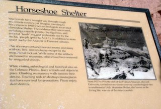
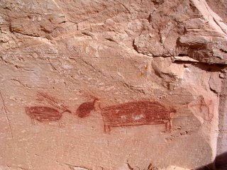
we got a bonus in Horseshoe canyon. Horseshoe is peppered with Pictographs that date back before AD 1. We were pleased to see them all (4 sites) along the way to the trailhead. Finally we arrived at the car around 12 noon. We had traveled 12.75 miles from trailhead to trailhead.
We were beat and ready for the ride home
PICTURES
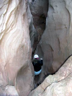
Picture #1: Jennifer first in at the chimney section
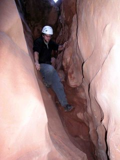
Picture #2: CL chimneying down the first 20-foot drop
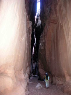
Picture #3: Looking back up the first part of the canyon. At the top you can see Jennifer and Nick starting to chimney down the crack
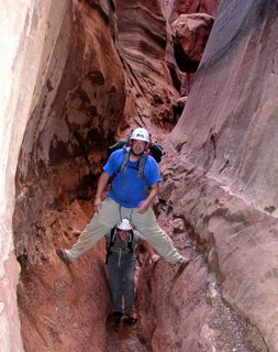
Picture #4: Nick trying to stay dry and CL being his comical self
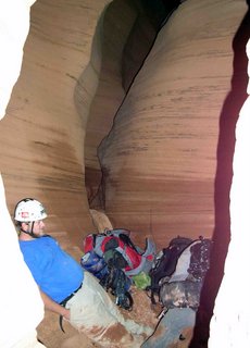
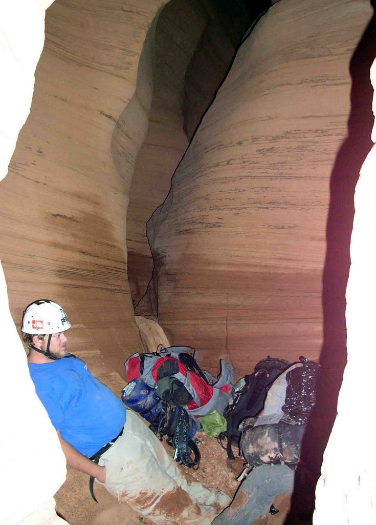
Picture #5: CL relaxing after passing under one of the many chokestones in the narrows
Picture #6: Jennifer walking down the upper narrows of Blue John
Picture #7: Nick relaxing before the water hole in the lower narrows
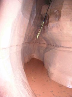
Picture #8: The water hole in the lower narrows
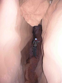
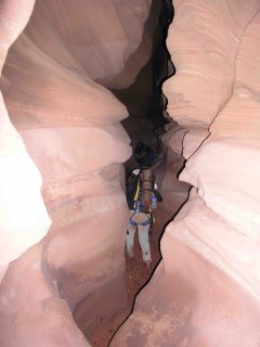
Picture #9: Jennifer walking through the dark narrows
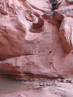
Picture #10: Jennifer doing the 60’ repel
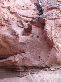
Picture #11: Nick on the 60’ repel
Picture #12: CL on the 60’ repel
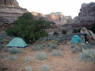
Picture #13: Camp 2 near the confluence of Blue John and Horseshoe Canyon
Picture #14: Nick and Jennifer looking at the Pictographs in the Great Gallery
Picture #15: Description found at the second set of Pictographs
Picture #16: One of the better Pictographs
Aron Ralston got trapped and had to amputate his own arm to survive in the dark narrows. I put it on the back burner and waited till it was old news and not such a popular designation.

Finally the planning was finished, the date was picked, and the climbing party was established (Nick Carlson, Chris Lighthiser - aka CL, Jennifer and myself), we set out for the 6 hour drive to Green River.
Once there we met up with a gentleman by the name of Phil. I had found his name through a series of calls looking for a shuttle. The plan was to have Phil lead us to the Horseshoe Canyon Trailhead where we would leave our car, then shuttle the four of us to the other end of the canyon to the west fork entrance, making it a Point A to B trip instead of a loop.
Phil dropped us off in the middle of the Utah desert and was unsure this was the correct place, but the GPS told other wise and I felt comfortable enough, so we decided to go for it. At this time it was raining extremely hard, so we threw together our packs and started towards the entrance of the canyon. We got to a patch of trees and decided to camp there.

The next morning, we awoke to sunshine, so we packed camp and began down the canyon. We got to the narrow section of the canyon and began the adventure. The first ¼ mile was a chimney down (a technique where you use your feet and arms to squeeze into the canyon and ease yourself down a vertical section).
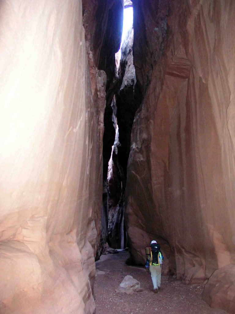
This was grueling and very tiresome but we eventually made it to the bottom of this section, packs and all, and began the hike into the narrow section of the canyon. The narrows were nice and long and we did not run into many obstacles. Once out of the narrows section, it was a good 2-3 mile exposed hike to the dark narrow section of the main fork.
Once inside the dark narrows, it became extremely tight, deep and dark. It began to squeeze down to the point where you could not have you pack on and dark enough to have to use your headlamp to see anything.

We made it to a part where Dave from the Hanns Flat ranger station had told us we could get into waist deep water. CL lowered me 10’ via belay into the water and sure enough, it was waist deep. Once to the other side we took a moment to think of a plan.

I would shuttle the packs across the water and then get under the others and help them down and limit how much they would get wet. Then CL would tie some webbing around a choke stone (a stone or rock washed down stream that gets wedge in the narrow canyon) and lower himself down into the water.
The plan worked well and everyone escaped without getting into the water.
After cleaning up and getting dry, we continued down stream. I was bringing up the rear and all of a sudden heard “HOLY COW” (language cleaned up for family viewing) come from the front half of the party.
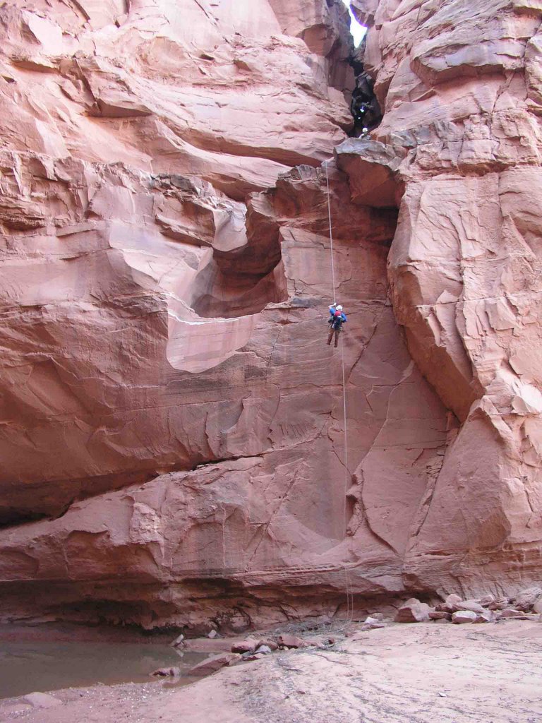
I turned a corner and saw what appeared to be longer than a 60’ drop to the canyon floor. We were prepared to repel down 60’ and were expecting it. But what we saw looked longer than that. We threw the rope over and there was less than 4 feet of rope on the ground.
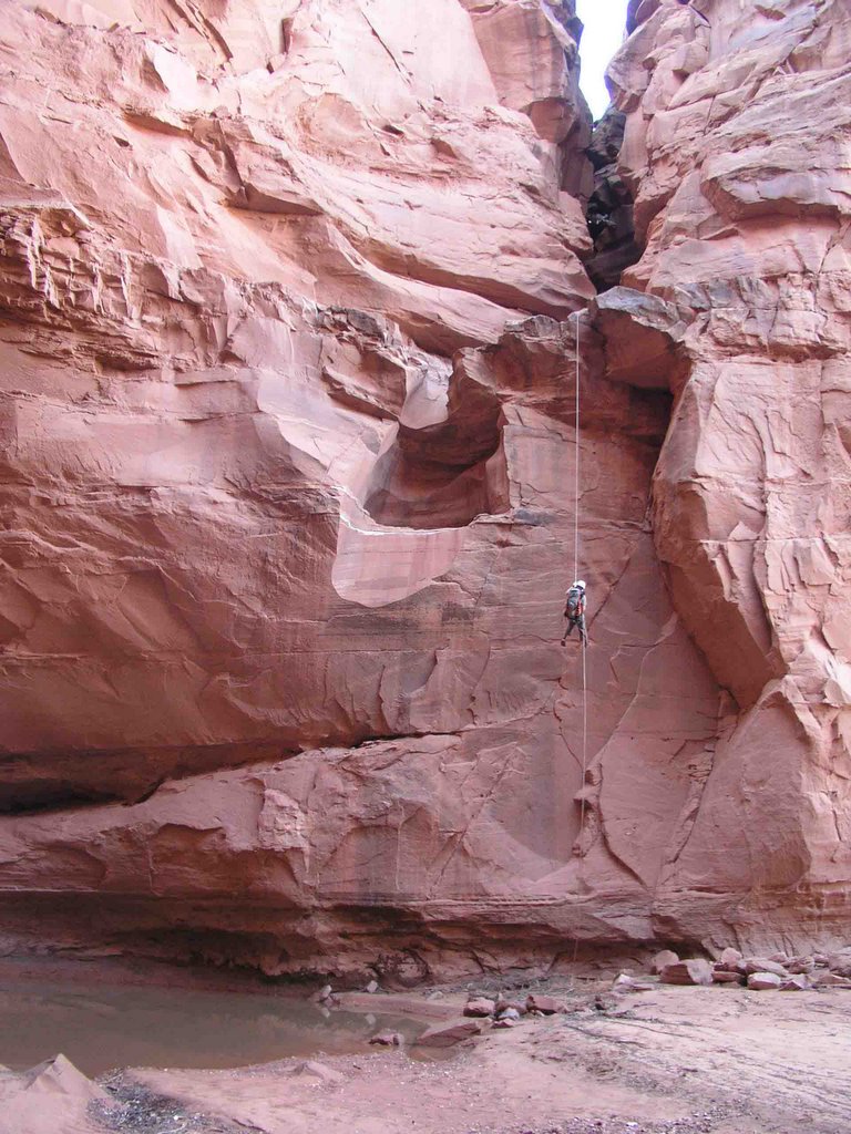
I was the first down, then my wife Jennifer, Nick followed and finally CL. We pulled the rope and we were off to campsite number 2 near the confluence of Horseshoe Canyon and Blue John.

Blue John opens up right after the repel and has multiple lush, tree covered camping spots. We arrived at the site just after 4 pm and had a good night sleep.Sunday we awoke, broke down camp and were off. Going the way we did, from one trailhead to the other,
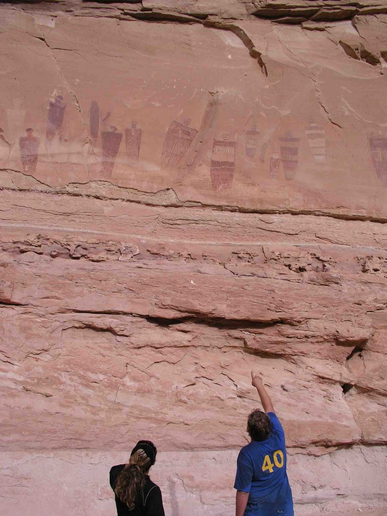
we got a bonus in Horseshoe canyon. Horseshoe is peppered with Pictographs that date back before AD 1. We were pleased to see them all (4 sites) along the way to the trailhead. Finally we arrived at the car around 12 noon. We had traveled 12.75 miles from trailhead to trailhead.

We were beat and ready for the ride home

PICTURES
Picture #1: Jennifer first in at the chimney section
Picture #2: CL chimneying down the first 20-foot drop
Picture #3: Looking back up the first part of the canyon. At the top you can see Jennifer and Nick starting to chimney down the crack
Picture #4: Nick trying to stay dry and CL being his comical self
Picture #5: CL relaxing after passing under one of the many chokestones in the narrows
Picture #6: Jennifer walking down the upper narrows of Blue John
Picture #7: Nick relaxing before the water hole in the lower narrows
Picture #8: The water hole in the lower narrows
Picture #9: Jennifer walking through the dark narrows
Picture #10: Jennifer doing the 60’ repel
Picture #11: Nick on the 60’ repel
Picture #12: CL on the 60’ repel
Picture #13: Camp 2 near the confluence of Blue John and Horseshoe Canyon
Picture #14: Nick and Jennifer looking at the Pictographs in the Great Gallery
Picture #15: Description found at the second set of Pictographs
Picture #16: One of the better Pictographs
posted by KJQHallquist at 11:46 AM
1 comments
![]()